
Category Weather And Climate
Weather vs. Climate: Decoding Earth’s Atmospheric Dynamics
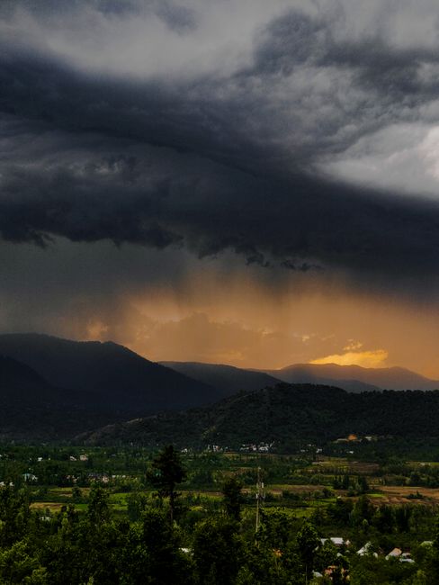
The distinction between weather and climate is fundamental to understanding atmospheric science and its far-reaching impacts. While often used interchangeably in casual conversation, these terms represent vastly different temporal and spatial scales of atmospheric phenomena. Weather refers to the short-term, day-to-day, or even hour-to-hour state of the atmosphere in a specific location. It encompasses variables such as temperature, precipitation (rain, snow, hail), humidity, wind speed and direction, atmospheric pressure, and cloud cover. For example, reporting that it is raining in London tomorrow is a weather forecast. Climate, conversely, describes the long-term average of weather patterns in a particular region, typically over periods of 30 years or more. It represents the statistical likelihood of certain weather conditions occurring. Therefore, stating that London has a temperate oceanic climate is a statement about its climate. This distinction is crucial for fields ranging from agriculture and urban planning to disaster preparedness and global environmental policy, as it allows for tailored strategies and informed decision-making based on either immediate atmospheric conditions or long-term trends. Understanding this dichotomy is the bedrock of comprehending Earth’s complex and dynamic atmospheric system.
Atmospheric Composition and the Drivers of Weather
The Earth’s atmosphere, a blanket of gases surrounding our planet, is the stage upon which weather unfolds. Primarily composed of nitrogen (approximately 78%) and oxygen (about 21%), with trace amounts of other gases like argon, carbon dioxide, and water vapor, its composition is not uniform and varies with altitude and location. Water vapor, though a minor component (typically 0-4%), is the most critical ingredient for weather phenomena. Its ability to exist in gaseous, liquid, and solid states drives the water cycle, leading to cloud formation, precipitation, and the release of latent heat, a significant energy transfer mechanism.
The primary driver of all atmospheric motion, and thus weather, is solar radiation. The Sun’s energy heats the Earth’s surface unevenly. Tropical regions, receiving more direct sunlight, absorb more energy than polar regions. This differential heating creates temperature gradients, which in turn lead to pressure differences. Warm air is less dense and rises, creating areas of low pressure, while cooler air is denser and sinks, creating areas of high pressure. The atmosphere constantly seeks to equalize these pressure differences through the movement of air, which we perceive as wind. Global wind patterns, such as the trade winds, westerlies, and polar easterlies, are organized by these large-scale temperature and pressure imbalances, influenced by the Earth’s rotation through the Coriolis effect.
Local weather is further influenced by a multitude of factors. Topography, including mountains and bodies of water, can significantly alter temperature, precipitation, and wind patterns. For instance, mountain ranges can force moist air upwards, leading to orographic precipitation on windward slopes and rain shadows on leeward sides. Large bodies of water moderate temperature, making coastal areas generally milder than inland regions. Surface characteristics, such as forests, deserts, and urban landscapes, also play a role. Forests can increase local humidity and transpiration, while urban areas, with their heat-absorbing concrete and asphalt, create urban heat islands, leading to higher temperatures compared to surrounding rural areas. These intricate interactions between solar energy, atmospheric composition, and Earth’s surface features generate the diverse and ever-changing tapestry of weather we experience daily.
The Nuances of Climate: Long-Term Weather Patterns
Climate is not merely an average of daily weather; it is a complex statistical description of atmospheric behavior over extended periods. This statistical representation includes not only the mean values of weather variables like temperature and precipitation but also their variability, frequency of extreme events, and seasonal patterns. The World Meteorological Organization (WMO) defines climate as "the statistical weather information that describes the variation in weather over a period of time for a given area." This statistical information is typically compiled over 30-year periods to smooth out short-term fluctuations and capture the prevailing atmospheric regime.
Several key factors shape a region’s climate. Latitude is a primary determinant, with areas closer to the equator generally receiving more solar radiation and thus having warmer climates. Altitude also plays a significant role, with higher elevations experiencing cooler temperatures. Proximity to large bodies of water, such as oceans and large lakes, exerts a moderating influence on temperature, leading to more stable and less extreme seasonal variations in coastal regions. Ocean currents are powerful transporters of heat, influencing the climate of adjacent landmasses; for example, the Gulf Stream warms Western Europe, giving it a milder climate than its latitude would suggest.
The distribution of landmasses and oceans also contributes to climatic differences. Continents tend to experience greater temperature extremes than oceans due to differences in heat capacity. Prevailing wind patterns, influenced by global atmospheric circulation, transport heat and moisture across the globe, shaping regional climates. Topography, as mentioned previously, significantly impacts precipitation patterns and temperature profiles. Furthermore, factors like vegetation cover and soil type can influence local and regional energy budgets and water cycles, contributing to climatic variations. Understanding these drivers is essential for classifying climates, such as the Köppen-Geiger system, which categorizes world climates based on temperature and precipitation patterns, and for predicting future climatic changes.
Classifying Climates: A Framework for Understanding Global Patterns
The classification of Earth’s climates provides a valuable framework for understanding the vast diversity of atmospheric conditions across the globe and for identifying broad trends and anomalies. These classification systems help us to communicate about climate with a common language, compare different regions, and anticipate the types of weather phenomena that are likely to occur in a given area. The most widely recognized and utilized climate classification system is the Köppen-Geiger climate classification.
Developed by Vladimir Köppen and later modified by Rudolf Geiger, this system categorizes climates based on statistical groupings of annual and monthly averages of temperature and precipitation. The Köppen-Geiger system uses a hierarchical structure of letters to denote different climate types. The first letter broadly categorizes climates into five main groups:
- A: Tropical Climates: Characterized by high temperatures and significant rainfall throughout the year, with no distinct dry season or with a short dry season.
- B: Dry Climates: Defined by a lack of precipitation. This group is further subdivided into arid (desert) and semi-arid (steppe) climates.
- C: Temperate Climates: These climates have moderate temperatures, with distinct warm and cool seasons. They are found in mid-latitudes.
- D: Continental Climates: Characterized by large seasonal temperature variations, with warm to hot summers and cold winters. They are typically found in the interior of continents.
- E: Polar Climates: Extremely cold climates, where temperatures remain below freezing for most of the year. This group includes tundra and ice cap climates.
Subsequent letters and numbers within the Köppen-Geiger system further refine these broad categories by specifying seasonal precipitation patterns (e.g., f for humid, w for winter dry, s for summer dry) and temperature extremes (e.g., h for hot, k for cold in dry climates; a for hot summers, b for warm summers, c for cool summers, d for extremely cold winters in temperate and continental climates). For example, a "Cfa" climate signifies a humid subtropical climate with hot summers, characteristic of regions like the southeastern United States.
Beyond Köppen-Geiger, other classification systems exist, such as the Trewartha system, which adjusts some boundaries and classifications based on vegetation distribution. Regardless of the specific system employed, climate classification is indispensable for comprehending global environmental patterns, agricultural suitability, biodiversity distribution, and the potential impacts of climate change on different regions.
The Interplay of Weather and Climate: A Dynamic Relationship
The relationship between weather and climate is one of interdependence and scale. Climate can be understood as the statistical sum of weather events over long periods, and conversely, long-term climatic conditions significantly influence the probability and nature of daily weather. For instance, a region with a Mediterranean climate (a type of temperate climate) is characterized by hot, dry summers and mild, wet winters. This climatic norm means that during the summer months, the weather in such a region is statistically likely to be hot and dry, with a low probability of significant rainfall. Conversely, a particularly hot and dry summer in this region, while a weather event, can be seen as an intensification or manifestation of its underlying climate.
However, it is crucial to differentiate between short-term weather fluctuations and long-term climate trends. A single unusually cold day in July in a generally warm region is a weather anomaly, not an indicator of a shift in the region’s climate. Conversely, a consistent pattern of warmer-than-average summers over several decades, accompanied by changes in precipitation patterns and an increase in the frequency of heatwaves, would suggest a climatic shift.
The concept of climate change highlights this relationship profoundly. Climate change refers to long-term shifts in temperatures and weather patterns, which can be natural or caused by human activities, primarily the burning of fossil fuels. These shifts are not about individual weather events but about the fundamental alteration of the statistical probabilities of various weather phenomena. For example, an increase in global average temperatures (a climatic trend) can lead to more frequent and intense heatwaves, more extreme rainfall events in some areas, and prolonged droughts in others – all of which are weather phenomena.
Furthermore, feedback loops within the Earth’s system can amplify or dampen climatic changes, influencing subsequent weather patterns. For example, melting ice caps reduce Earth’s reflectivity (albedo), leading to increased absorption of solar radiation and further warming, which in turn can lead to more ice melt. Understanding this dynamic interplay is paramount for predicting future climate scenarios and developing effective mitigation and adaptation strategies to address the challenges posed by a changing global climate. The distinction between weather and climate allows us to analyze immediate atmospheric conditions for planning and preparedness while simultaneously studying long-term trends to understand and address the overarching challenges of our planet’s evolving atmospheric system.
